|
|
|
|
|
|
|
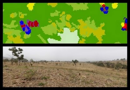
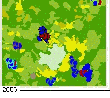
MoPAgrIBMoPAgrIB is a simulator of savannah landscape mosaic under shifting cultivation. The study area is Wanté village located at the foot of Poli massif in North Cameroon. The village is composed of sixty households, who are all from the Duupa ethnic community. All of them are farmers.
The landscape is mainly characterized by the presence of cultivated patches of 2 to 10 ha, distributed in the savannah with no regular pattern solely attributable to distances from the habitat, land ownership or soil quality.
Various scenario have been simulated as the one shown here. It simulates the landscape evolution from 2006 to 30 years beyond and explores the relation between the spatial extent of agriculture and the farmers social position.

The development of MoPAgrIB model is carried by multidisciplinary research team.
The model can be download here. It requieres Cormas march 2008 version as well as some Cormas add-ons which you can download here.
|